![]()
Grand Rapids, Michigan
Team GE Aviation
Flight Deck Lateral Map Display
Winner of the Design Day Auto-Owners Exposition Award.
Given the safety critical task of piloting an aircraft, the aviation industry is continuously seeking to improve pilot performance. One such tool aimed at improving situational awareness is the Flight Deck Lateral Map Display (LMD). This software provides multiple views of an aircraft’s situation, giving a pilot valuable flight data that might otherwise not be available.
By utilizing flight simulation software to stream data over a simulated aircraft network, the LMD is capable of displaying a multitude of information in various layers.
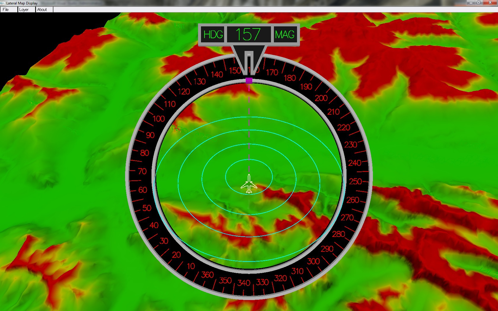
Terrain elevation and distance are rendered in multiple ways. A top down (or plan view) rendering is displayed around the plane icon and is shaded depending on the theoretical danger level. Terrain that is significantly above the aircraft is color coded red while terrain significantly below the aircraft is colored green. A second form of display is a side (or profile) view where the danger levels are shaded in the same manner.
Other features include weather, waypoints, other air traffic, airports,
state and country lines, wind speed, and ground speed.
The weather layer uses a worldwide map to accurately display the current
weather at a given location. Location data is derived using the
aircraft’s latitude and longitude and updates based upon rotation and
zoom.
The Lateral Map Display is particularly useful when visibility is poor. Using this tool, the pilot has the ability to determine their heading, see their flight plan, and avoid hazards such as terrain, air traffic, and weather.
The LMD is written in C and utilizes the OpenGL API.

Team GE Aviation
Flight Deck Lateral Map Display
MSU Team Members
Jason Rigdon, Novi, Michigan
Jordan Clare, Westland, Michigan
Adam Dupler, Rochester, Michigan
Cory Sites, Grand Ledge, Michigan