
KML Urban Scene Builder 2009
In the heat of battle, soldiers are forced into making tough decisions that can determine the fight's outcome. Having the ability to plan how strikes are to be carried out significantly raises a unit's chances of success. Using the simulation software that we've developed this semester, any military organization can do just that.
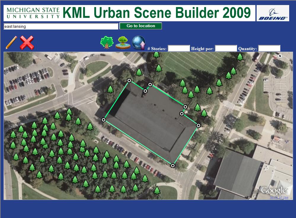
Using images taken by satellite, users are able to trace out building layouts, or footprints, which are built into three-dimensional models. After adding other objects such as stairwells, couches, and tables into these models, the full-scale building is loaded as one of many into a vast scene. This, however, is simply the first step of the software package.
The real meat and potatoes of our application is being able to drive a vehicle through the simulation which not only shoots lasers but also forwards messages about what was shot at over a network that others watching the scene can connect to.
While piloting about the scene, the user may fire a laser at any object, including walls and ceilings outside and inside of buildings. Should the object become damaged or destroyed, a message is sent over the network to anyone who is connected and watching so that they can know what has just occurred.
Our software was written using C++ applied to the OpenEaagles Distributed Interactive Simulation framework with embedded Ruby scripting. Google Earth provided all satellite images used for the footprint creator.
David Bedell, Taufik Hidayat, Keith Schonberger, Nicholas Ramirez
![]()
![]()
![]()
![]()
![]()
![]()
![]()
![]()
![]()
![]()
![]()